1984 → NOW
Land history
See how the site changed.

Check one parcel, analyse a project or compare locations—all in one map.
See flood indication, terrain, land history and nearby essentials before paying a deposit.
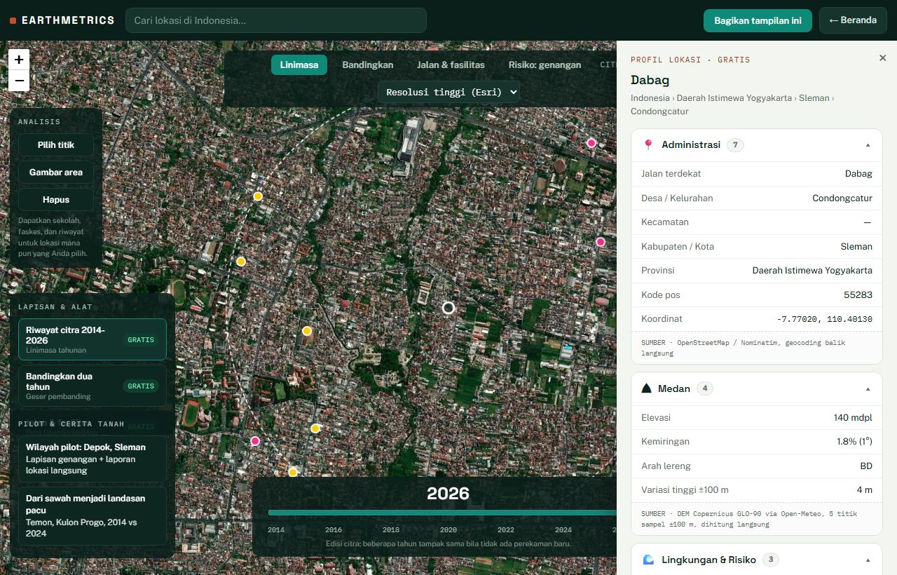
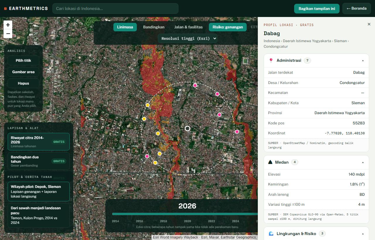
Ready-to-use imagery, context and export for daily GIS work.
Score every candidate with consistent land, access and risk criteria.
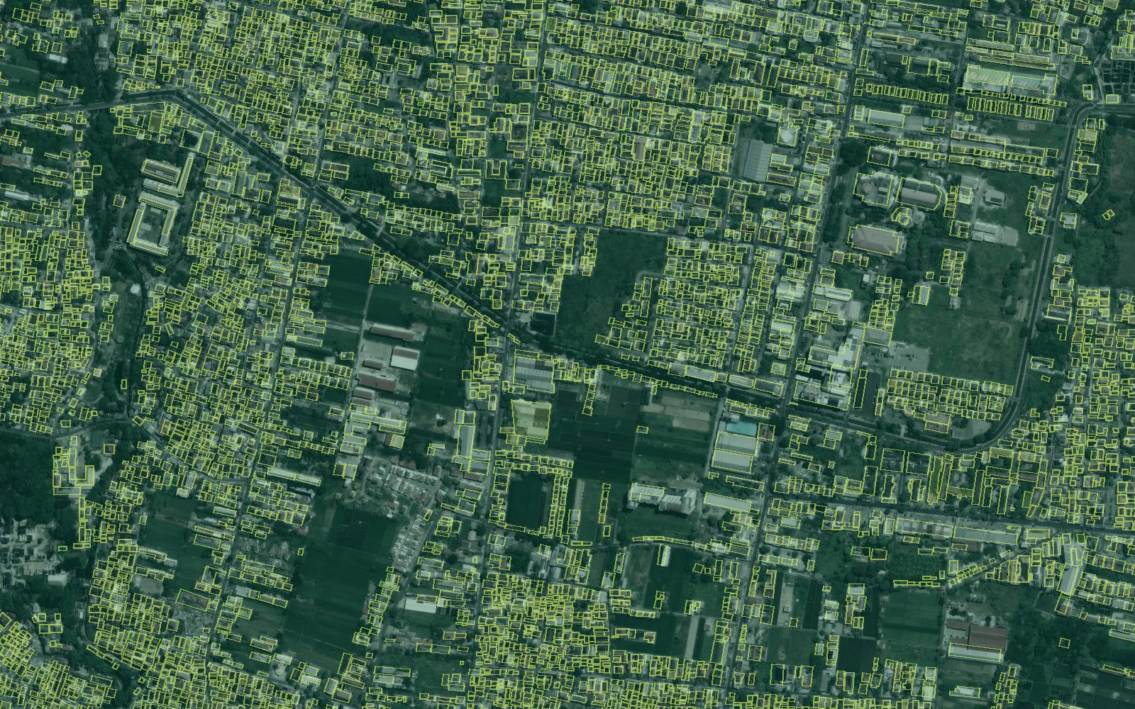
The technology stays behind the decision.
See how the site changed.
Reveal slope, drainage and exposure.
Understand access and nearby facilities.
Turn layers into a sourced, readable brief.
Every output names its source and the right official verification route.
Administration, terrain, land cover, facilities, imagery history and regional indicators.
Landsat-era change context plus annual high-resolution and Sentinel imagery editions.
Web map, PDF reports, map export, geospatial files and private workspaces.
Reports are not legal title checks. Registered ownership is verified through BPN and PPAT.
One parcel, a daily workspace or a private team project.
Explore imagery history, compare years and create a location profile without installing software.
AvailableContinue with PNG, CSV and GeoJSON outputs in GIS, reports or spreadsheets.
ProfessionalBring internal layers and team members into a separate project environment.
BusinessIntegrate location profiles and selected layers into another system.
In developmentThe map is useful because its sources and limitations remain visible.
| Layer | Source | Status |
|---|---|---|
| Imagery history, 1984–2026 | Esri Wayback, Sentinel-2 and Google Earth Timelapse | Ready |
| Flood indication | Copernicus GLO-30 terrain model; computed in house and labelled as an indication | Ready · pilot areas |
| Elevation, slope and aspect | Copernicus DEM via Open-Meteo | Ready |
| Land cover | ESA WorldCover, 10 m | Ready |
| Schools, health facilities and roads | OpenStreetMap, Dapodik and Ministry of Health sources | Ready |
| Regional socioeconomic indicators | BPS and Ministry of Manpower; regional and rounded | Ready · regional |
| Official hazard mapping | InaRISK BNPB | Partial availability |
| Parcel and spatial-plan references | BHUMI and GISTARU ATR/BPN | Coverage varies |
| Registered owner and legal title | Not open data; requires formal verification | BPN / PPAT |
| Transacted market price | No comprehensive open national source | Manual evidence |
A parcel, a planning project or a shortlist of strategic sites is enough to begin.